Tag: saskatchewan

A Week in Saskatchewan

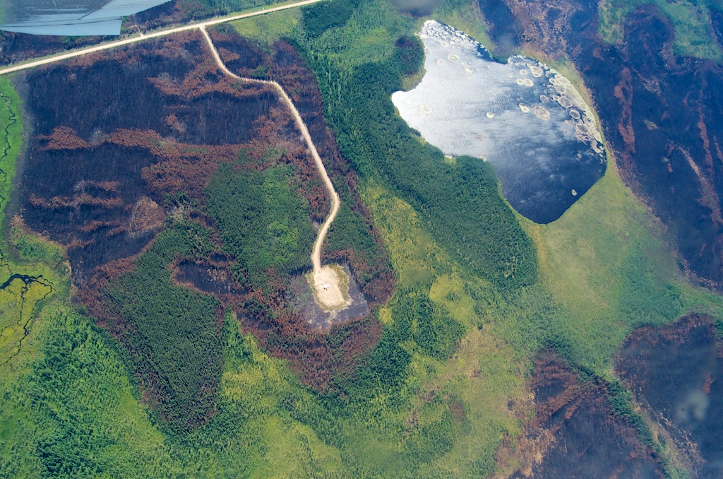
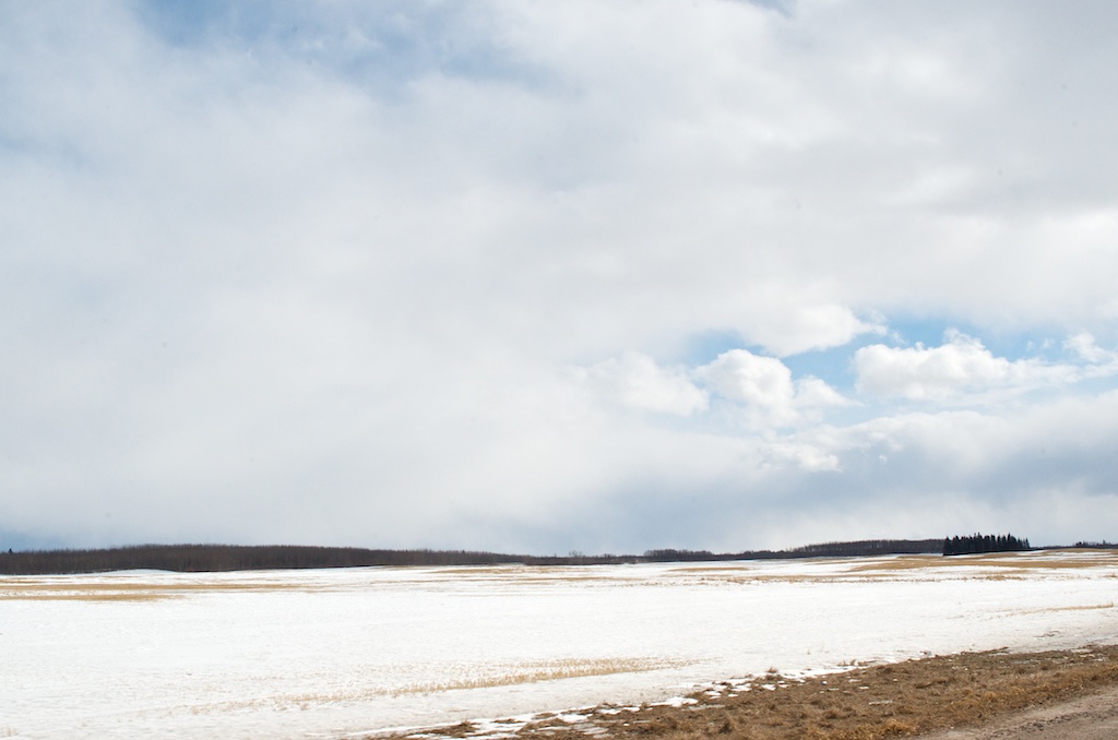
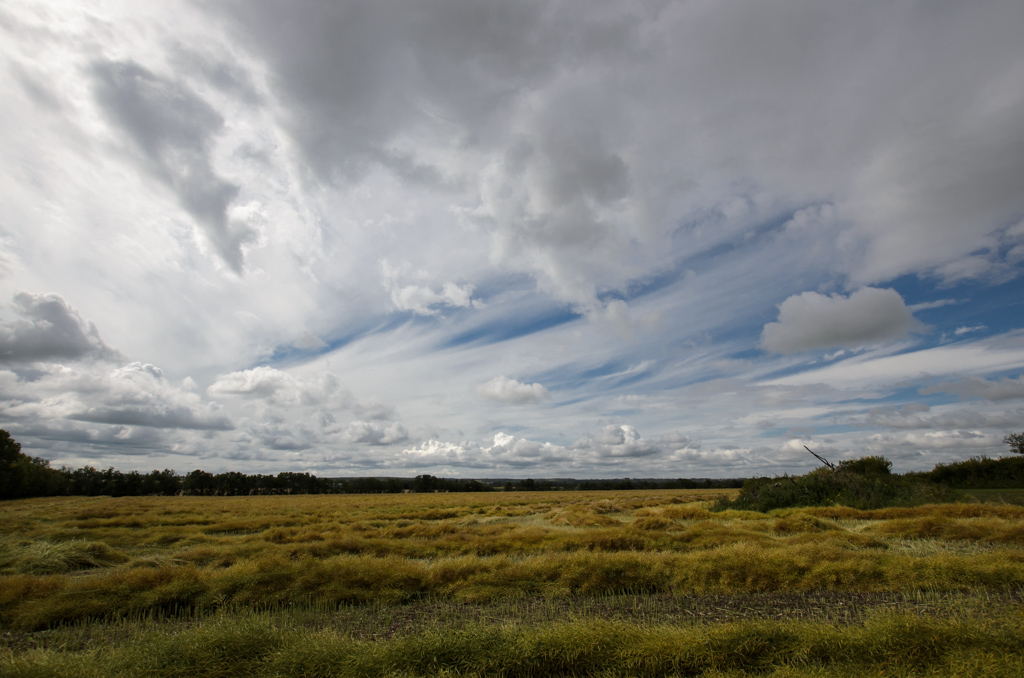
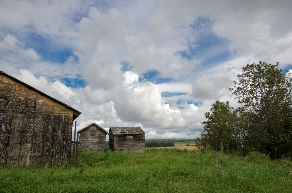
I spent the week out in the Meadow Lake, SK area. Although the forecast kept threatening rain, we only got some the Monday night and the rest of the week was pretty good. A canola crop freshly harvested, it sits for 18 days before they collect it.

20160825-D7K_2791

20160825-D7K_2792

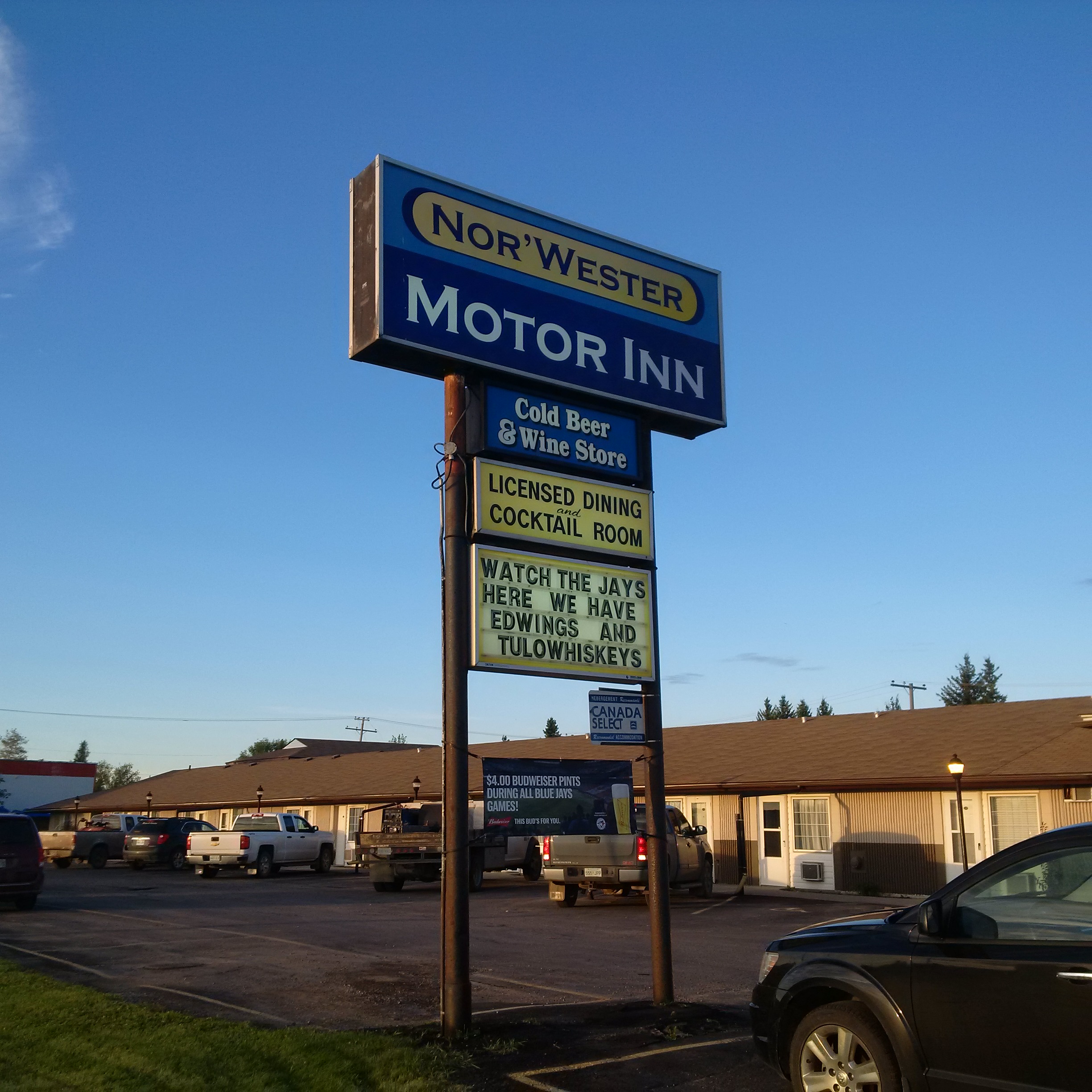
I’ve never stayed at the Nor’Wester Motor Inn, although I’ve bought expensive beer from the Cold Beer store and have eaten at the restaurant once.

IMG_20160824_194618

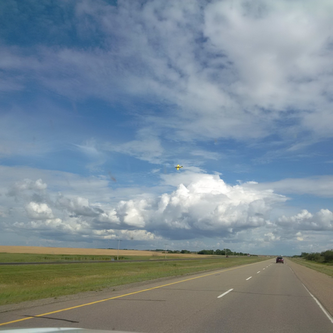
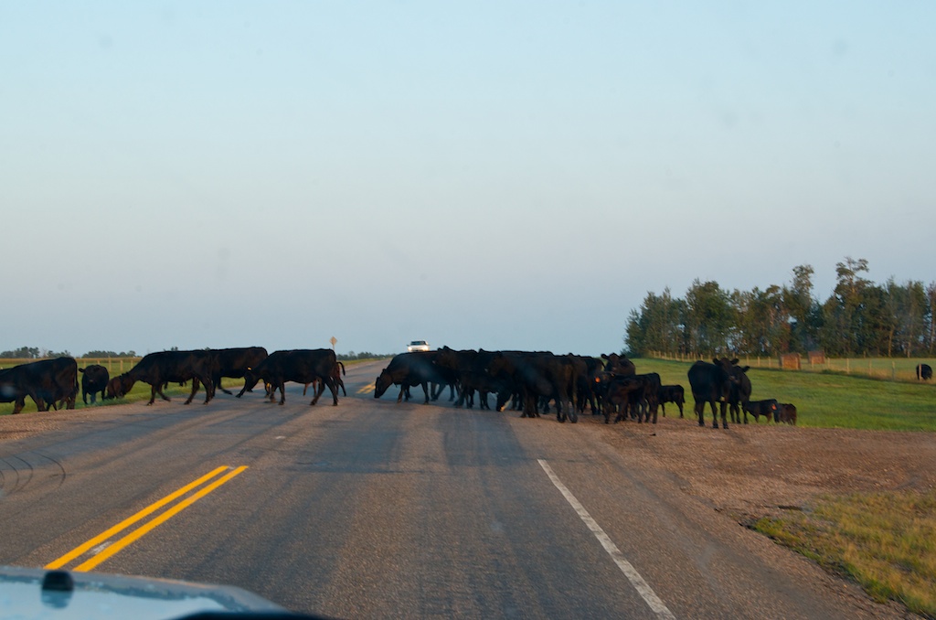
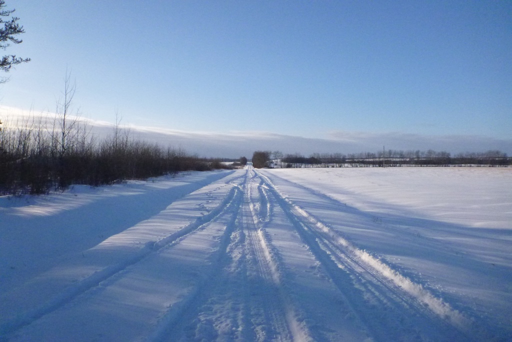
Traveling back to Saskatoon on the Yellowed Highway.

IMG_20160825_155426_edit


Northern Saskatchewan and NWT Trip

I had an extended trip out west, a colleague and I were sent out to our two sites that were impacted by the forest fires this summer. It was a 10 day trip that took us to Pinehouse Lake, SK and Fort Smith, NT. We flew into Edmonton, rented a truck and drove to Beauval, SK. This was the sunrise on Lac La Plonge.

Click to enlarge photos

The accommodations were a little sparse, there was no internet or television for a few days.

Click to enlarge photos

On our third day we drove to La Ronge to catch a charter flight to do an aerial assessment of our site. The plane was a Cessna 185 float plane, it was the first time I have taken off and landed on water.

Click to enlarge photos

The road and our site at the end of it. The black and brown areas are all fire damaged. Even though the plane ride was a little rough, it was an awesome opportunity.

Click to enlarge photos

On the Friday we headed back to Edmonton to catch our flight to Fort Smith. It was about 6:30 when we came across a herd of cows blocking the road. Eventually with a little honking and inching forward, they moved out of the way.

Click to enlarge photos

We only had a few days in Fort Smith. We saw this small group of bison on the way back to town on the Saturday.

Click to enlarge photos

There were three adults and a couple of younger ones.

Click to enlarge photos

What my telephoto lens lets me see. I was in the drivers seat and they were on the passenger side of the highway. I had the back window down and pointing my lens towards them.

Click to enlarge photos

Sunday was an off day for us, so we headed down to Mountain Rapids to see if we could see the nesting Pelicans. They were all on islands pretty far away.

Click to enlarge photos

The scenery on the Slave River is spectacular.

Click to enlarge photos

Click to enlarge photos

The Mountain Rapids.

Click to enlarge photos

Click to enlarge photos

Click to enlarge photos

We were able to watch the end of the Blue Jays/Yankee game when we got back to town. After the game we headed to Grosbeak Lake.

Click to enlarge photos

Click to enlarge photos

Click to enlarge photos

Click to enlarge photos

Click to enlarge photos

Some bison footprints in the mud.

Click to enlarge photos

Even though it looks like two rocks it is just one rock that has eroded over the years by the salt.

Click to enlarge photos

We set our alarms for the second last night to see if we could see the Aurora Borealis. We drove down to the river around 12:30am.

Click to enlarge photos

Those are lights from another vehicle that pulled up while we were there.

Click to enlarge photos

It was kind of odd, as the colours were not as vibrant as they appear in the photos. We could see some of the green, but not much of the purple.

Click to enlarge photos

Note the Big Dipper in the top left of this photo.

Click to enlarge photos

Most of these photos were taken at a 30 second exposure on a Gorillapod on the roof of the truck.

Click to enlarge photos

Click to enlarge photos

Click to enlarge photos

Click to enlarge photos

Click to enlarge photos

On the Monday we had another charter booked with Northwestern Air Lease. This time our plane had wheels. It was a Cessna 206, a little bigger than the previous one. As the pilot said, this was more like the station wagon of Cessna’s.

Click to enlarge photos

The scenery below was a little more interesting.

Click to enlarge photos

Some of the burn area, that is the main highway that goes between Fort Smith and Hay River.

Click to enlarge photos

Click to enlarge photos

The Slave River.

Click to enlarge photos

Our last night in Fort Smith we headed down to the Rapids of the Drowned. They are right in town and a short hike down to the river from town. The Pelicans were still far away, not as close as they were in May when I saw them.

Click to enlarge photos

Click to enlarge photos

A final sunset over the Slave River.

Click to enlarge photos

Click to enlarge photos

Click to enlarge photos

Day 10 and we had an early flight from Fort Smith to Edmonton via a stop in Hay River. On the flight to Hay River there were three of us on the British Aerospace Jetstream 31 that can hold 19 passengers.

IMG-20150818-00753

After we landed in Hay River to drop off one pax, the pilot said we were it to Edmonton. So my colleague and I had a private charter from Hay River to Edmonton.

IMG-20150818-00754


Pinehouse, SK

My work travel slowed down this winter, in February I only traveled to Pinehouse, Saskatchewan. It was a cold week with temperatures in the minus 25 to 35 in the morning each day.

20150210_D7K_5505

The Environment Canada weather site had an issue the one morning, for most of the forecasts they were missing the “-” sign in front of their temperatures. According to my BlackBerry, the EC weather.gc.ca site was showing Buffalo Narrows, SK (closest town to Pinehouse) with a temperature of 33.6 degrees C.

20150211_D7K_5513


Storm Clean-up

I was out to Bratt’s Lake, just south of Regina this week for a few days. We were out there to clean up some damage from a thunderstorm system that went through about 3 weeks ago. According to Environment Canada, the storm that went through August 8th was not a tornado. They said the damage was very likely caused by straight line winds and not a tornado. The Doppler radar estimates had winds as high as 140 kilometres per hour. It picked up one of our 10×10 buildings and tossed it across the field. The bare patch is where it was originally, the blue dumpster is where most of it ended up.

20140825_D7K_4180

A closer look at some of the damage.

20140825_D7K_4185

It crumpled the walls and roof.

20140825_D7K_4189

It was a big job to dismantle it enough in order to throw it in the dumpster.

20140825_D7K_4192

We ended up filling two 20 yard dumpsters.

20140825_D7K_4196

This was the first dumpster being hauled away.

20140826_D7K_4205


Buffalo Narrows

I had one last trip before some holidays this summer. I was back out to Saskatoon and then onwards to Meadow Lake, Pinehouse and Buffalo Narrows. It was a successful trip.

There was lots of black bears, deer and Sandhill cranes along the roads. In Buffalo Narrows there is a colony of White Pelicans. On both days we saw a doe with two baby deer in tow. This is a photo of one of them.

20140722_D7K_3358


Quick Saskatchewan Visit

After Claudia’s graduation I was out to Saskatoon and a couple of points north, namely Flat Valley, Meadow Lake and Pinehouse before heading back early Friday morning.  Unfortunately, things did not go as planned which means a return trip next month.

20140625_D7K_2889


Island Falls, SK

This past week had me up in northern Saskatchewan for work. I was doing an installation at our Island Falls, SK site with two other guys. The site is located at the Island Falls hydroelectric power generating station. This is the view from A-dam.

Most of the ice is off of the Churchill River.

There was a groundhog (Marmota monad) that kept showing up at the same time of the day near our building, makes me wonder if one of the operators feed it.

Making a run for it.

The copper smelter was closed in June 2010.

Before heading to the airport we stopped at the local tourist park with the statue of Josiah Flintabbatey Flonatin, a science fiction character from the novel “The Sunless City” by J.E.  Preston Muddock.

Flinty is 24 ft tall and was constructed in 1962. It was designed by cartoonist Al Capp.

To get to Island Falls, it is either an 8 hour drive from Saskatoon or a 1 hour flight from Winnipeg to Flin Flon and then another 3.5 hour drive from there.  Here is the flight path from Winnipeg to Flin Flon. Calm Air is the only airline going there now that Bearskin Airlines no longer has daily flights. While we were waiting to board our flight a RCMP jet came in with a prisoner to make a court appearance in Flin Flon. The provincial court sheriffs were there to take custody of the prisoner. When they are arrested they are shipped to Prince Albert to await trial and then flown back to the local community.


Flat Valley Solar

I was out in Flat Valley, Saskatchewan this week installing a solar array at one of our temporary sites.

We are set-up on the property of the landowner who holds our lease for our permanent site about 1km away.

A view to the south, we should no problem finding the sun.

On the way back to Saskatoon, we stopped in North Battleford to see the giant Mountie on a horse. It is 23 feet high and was built in 1963.

Nearby is this buffalo that is made from barbed wire.


Pinehouse or Bust!

Turned out to be ‘bust’. I was out to Pinehouse, Saskatchewan to our new site. We were there for what was to have been the final inspection before being turned over to us. Unfortunately it didn’t quite turn out that way, some mis-communication along the way resulted in an unnecessary trip. The big black raven in the photo below was probably some sort of sign. There should have been buildings sitting on the concrete pads and the electrical power service was to be complete. There was no service to the buildings or from the transformer to the meter. Also had a visit from the local RCMP regarding some shady contractors. As a result, it may require another trip out there before we can do the installation.


Flat Valley, SK

I had a short trip out to Flat Valley Saskatchewan to mark out a new site. This site has a lot of deciduous trees, so it would be easier to mark it and move around in the winter. It was a flight into Saskatoon and then a three and a half hour drive north west. Latitude wise it is further north than Edmonton.

The night we arrived there was 10-15cm of snow added to the already foot of snow on the ground, the only good thing is the snow is so dry, it is easy to move around. It was also easier when following the many deer trails. As we walked in there was one laying in the bush that jumped up and took off.

The forecast was for cloudy and overcast, but the closest city that the forecast was based on was 65km away. The sun was in and out throughout most of the day.

Our site is on the edge of a 150 acre forest.

We are in the middle of farming country, mainly hay and grain.

North of the site it is wide open fields.

Was able to change my flight when I checked in to a direct flight to Toronto, rather than my connection through Calgary. It was suppose to get me home 3.5 hours earlier. When we got to Toronto we were delayed and circled 25 minutes due to the snow. Then there were mechanical problems with the plane so our baggage was delayed and then had the usual friday afternoon taxi line followed by another hour in traffic on the 401. Probably should have declined the direct flight.