From Here To There... Categories
Scenery
« Movies |
Main
| Signs »
Tuesday, July 08, 2008
Anchorage to Fairbanks
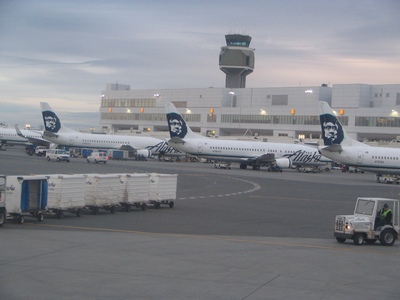
It was an early start to the morning with a flight from Anchorage to
Fairbanks at 6:00am.
It's even earlier when the body hasn't adjusted and it's still waking up
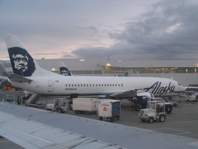
at 3:30am. The flight was on Alaska Airlines.
The plane was a 737-400 combo plane. The front half is for cargo and the
seats start at the middle and towards the rear.
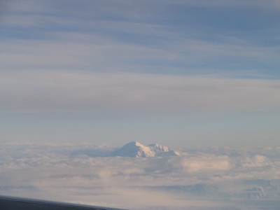
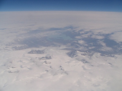
As we flew from Anchorage to Fairbanks, Denali (Mount McKinley) rises
from the clouds. Denali is the highest mountain peak on North America at
20,320 feet.
I'm currently reading "Forever on the Mountain", it is a detailed
account of the doomed 1967 Wilcox-McKinley Expedition. In the end only
five of the twelve expedition members survived.
A closeup of Mount McKinley.
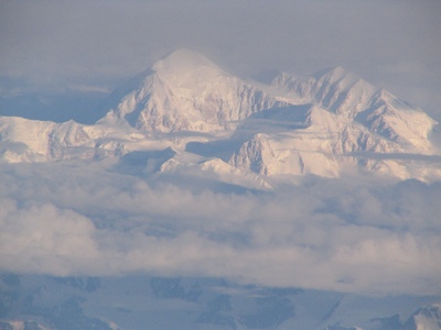
Mount McKinley is located in the Alaska range.
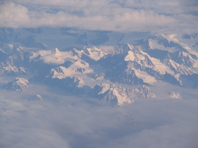
Another view of Mount McKinley as we passed by.
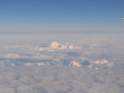
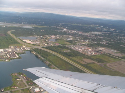
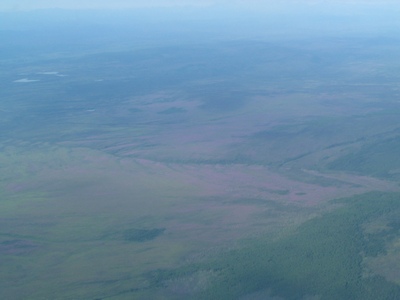
Eventually we hit the Interior area which is fairly flat and green.
Making the approach into Fairbanks.
Fairbanks to Bettles
After landing in Fairbanks we had an hour before our flight to Bettles.
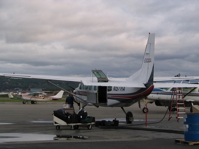
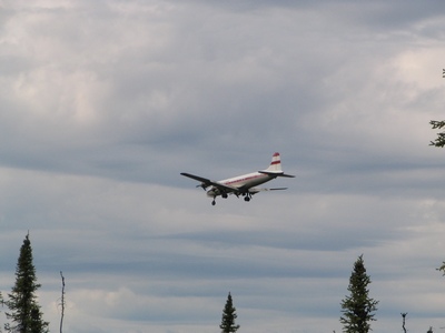
Little did we know that we had to take a taxi to the other side of the
airport to catch the air taxi. This was the airplane that took nine
people to Bettles.
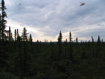
It was a cloudy, overcast day as we flew to Bettles.It took just over an
hour to fly there.
We flew over parts of the Alaska pipeline. That building in the middle
of nowhere looked like some sort of sub-station for the pipeline.
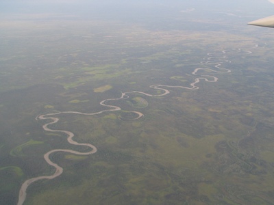
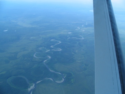
There were lots of meandering rivers and oxbow lakes from when the path
of the river changed.
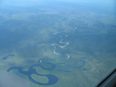
It might be hard to see but there was an area that appeared purple, it
was probably from wildflowers, but it only seemed to be the one area.
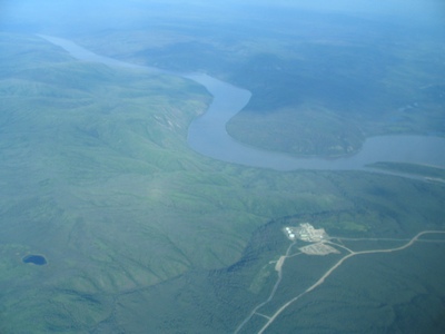
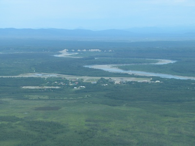
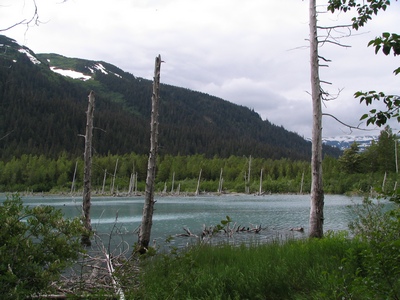
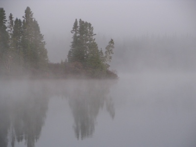
The float pond at Bettles. Bettles is a starting point for many people
who go hiking/exploring in the Gates of the Arctic National Park. The
only way in is by small float planes. We actually landed on the gravel
airstrip.
The city of Bettles,
Alaska. The Koyukuk River runs nearby. The original Bettles started in
1899 as a gold rush trading post.
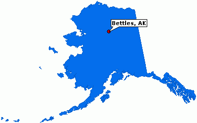
Bettles, Alaska
Bettles is further north than Iqaluit, Nu but not further north than
Pond Inlet (or Alert). A map showing where Bettles is located.
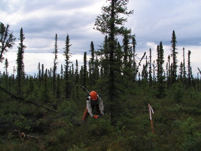
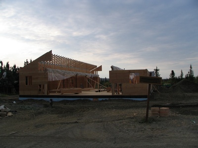
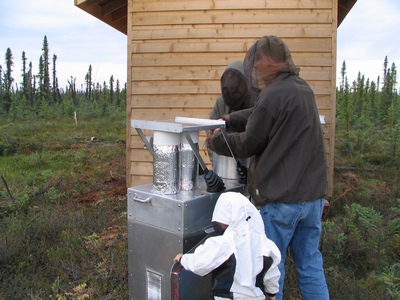
The site was on the north side of town. Some of the trees had to be cut
down and cleared. The ground was like walking on sponge. It wasn't flat
and some places would suck you in. Below it a few feet is the permafrost
layer.
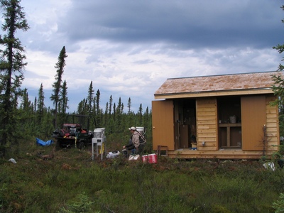
This building was made in Fairbanks and brought up to Bettles on the ice
road last winter. There was no power at the site yet, it seems the
National Park Services gets tied up in the same red tape and levels of
bureaucracy that we encounter when setting up our sites. They had a
portable generator for the training of the operators.
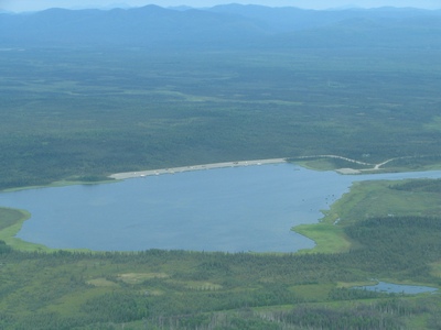
The airstrip at Bettles is quite busy, they are three air taxi companies
that fly in and out a couple of times a day.
It was very quiet and peaceful at the site, save for when the generator
was going. Also the constant hum of the mosquitos in your ear was
distracting.
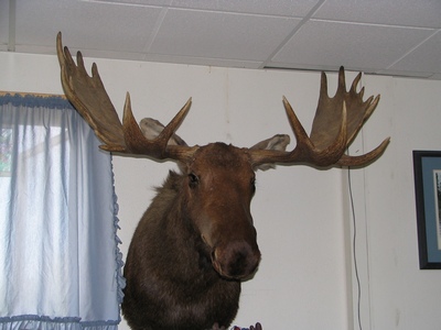
This guy was hanging on the wall in the lounge of the lodge I was
staying in.
Wednesday, July 09, 2008
Around Town
I can now say I have been to the remote interior of Alaska and survived.
On the second day I went for a walk around town. And when I say town it
is just a few buildings. It wasn't quite 24 hour sun, but pretty close,
there were only a few hours of night, the days would start getting
shorter by a few minutes each day until they hit 24 hour dark by
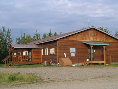
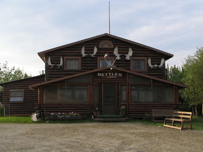
November. This is the building I stayed in, it is part of the Bettles
Lodge.
This is the new National Park Service Visitor Centre that was being
built. It was replacing a previous one which burnt down a few years ago.
The NPS, the Fish and Wildlife Service, airport and the Bettles Lodge
are the main employers.
There are only two lodges in town, but both are now owned by the same
person. It use to be separate families and it was pretty much a
Hatfield-McCoy type of deal. Eventually one drove the other out of
business.
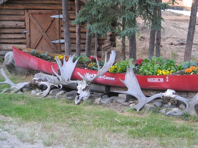
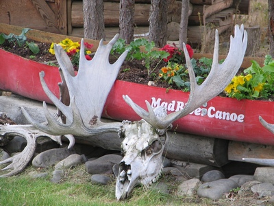
A close-up of the moose skull.
Much of the time I was in Bettles it was sunny, partly cloudy. Yesterday
we watched a storm blow around us. There was thunder and lightening, but
we missed most of it.
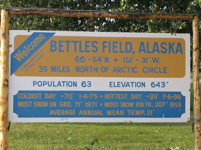
Some stats on Bettles. Although it is called Bettles it is really
Bettles Field, the original town is downstream, but was pretty much
abandoned once the airstrip was built.
The main Bettles Lodge. There is a large portion of tourists from Japan
and Germany. The majority of them pay big bucks to come in
February-March during the prime Northern Lights (Aurora Borealis)
viewing period.
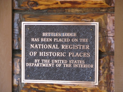
It is a Historic Place.
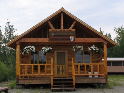
The Bettles Ranger Station. Most of the National Parks Service staff are
seasonal, except for one lone guy who stays through the winter to keep
the buildings going.
We had to make another trip out to the site. The mosquitoes were even
worse than the previous day. Those birds in the picture are actually
mosquitoes.
Everyone had on their bug dope and bug jackets on today.
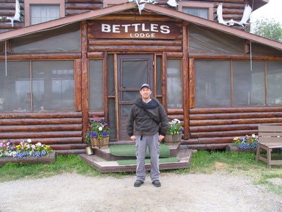
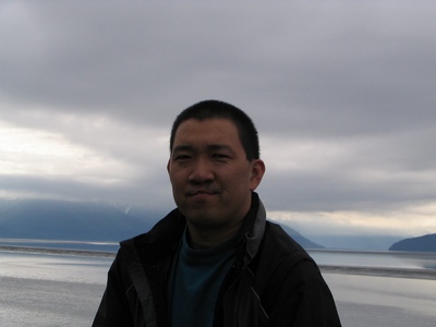
Here I am in front of the lodge.
Thursday, July 10, 2008
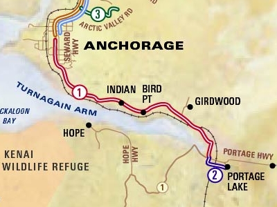
South of Anchorage
I had some time on my last day in Anchorage to take in some sights. I
decided to rent a car and drive south of Anchorage towards Portage Lake.
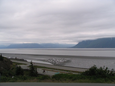
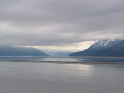
This is Turnagain Arm, you can see the mudflats in the foreground. A
couple of people have died after venturing out and getting stuck in the
fine silt and then being unable to get their leg free as high tide comes
in.
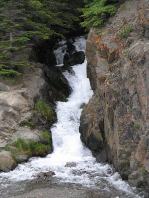
This is McHugh Creek, just one of many that flow down towards Turnagain
Arm.
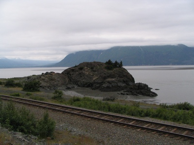
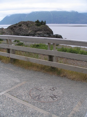
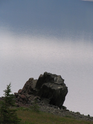
This was Beluga Point, didn't see any belugas though because of the low
tide.
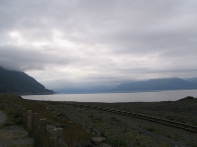
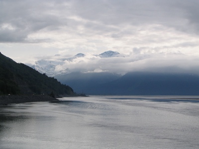
Looking east in towards the arm.
A compass on the ground to orient yourself.
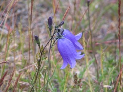
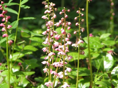
Some wildflowers near one of the lookouts.
Most of the drive was in cloudy overcast skies.
A timer picture of me.
Turnagain Arm is one of the few places in the world (about 60 places)
that have tidal bores. The Bay of Fundy being one of the larger tidal
ranges.
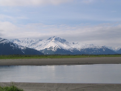
This was closer to the Portage turnoff.
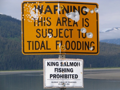
There was no sign prohibiting the use of firearms.
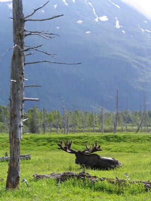
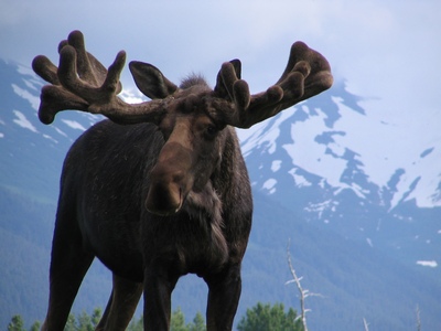
I was able to see a moose in his natural habitat.
And then I saw some muskox by the side of the road.
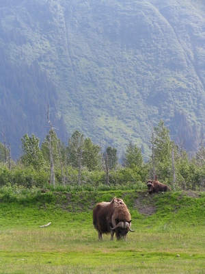
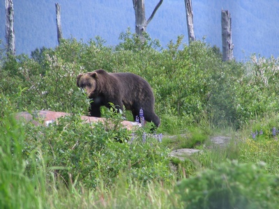
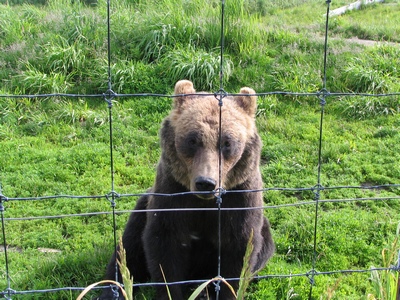
And wouldn't luck have a brown bear was off in the distance.
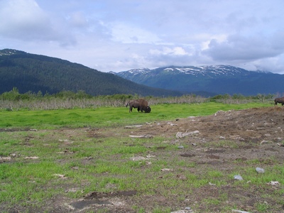
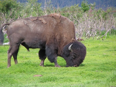
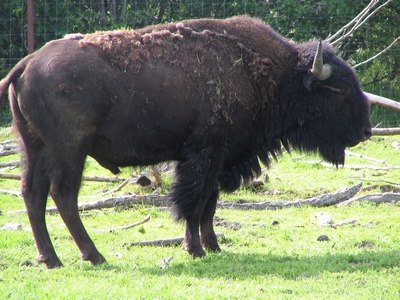
There were a couple of wood bison minding their own business.
I wasn't sure if this moose was thinking of charging.
You must of figured out by now that these animals weren't quite as free
and wild as they look. Close to the Portage Lake turnoff is the Alaska
Wildlife Conservation Centre. This place takes in injured or
orphaned animals. You can either drive through it or park and walk
through. Here is a close-up of the Wood Bison, this herd was from
Canada, they are there for a couple of years and then they will be
released into the wild.
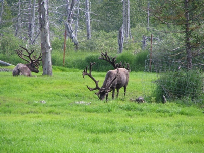
They had the Sitka Black Tailed deer and elk mixed in together.
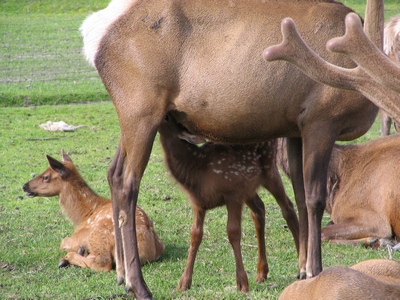
Caribou or "reindeer" grazing in their compound.
This was a Plains Bison different from the Wood Bison above.
The brown bear sitting for a picture. As you can see there isn't much
between the bear and me, it is about 6ft away, behind an electric fence,
the fence and then a rail fence on my side.
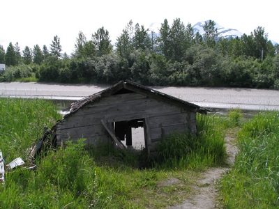
This cabin is the remenants of the 1964 earthquake that hit Alaska, it
register 9.2 on the Ricter scale, the largest ever in the Northern
Hemisphere. The town of Portage was destroyed, and many areas dropped so
much that the saltwater killed much of the low lying forests and
surrounding vegetation.
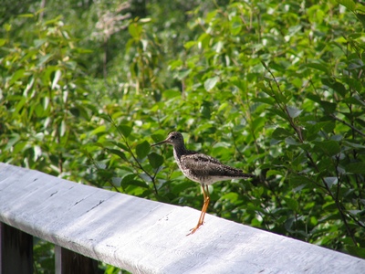
This bird kept flying around when I was walking along a trail.
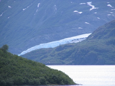
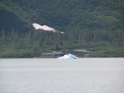
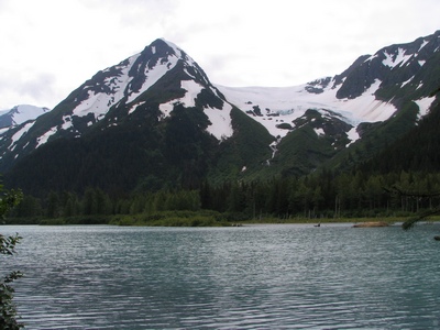
This is Portage Lake, the icebergs are from the Portage Glacier. The
glacier comes down and enters the water and extends about 100 feet into
the water.
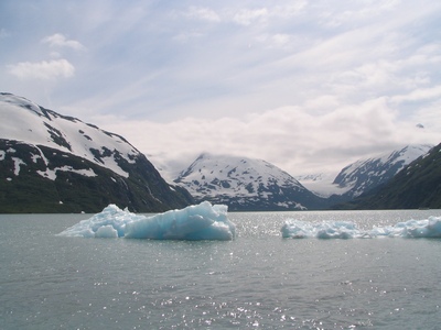
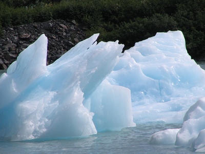
The glacier use to extend right across the lake, in order to see it
close-up you need to take a cruise boat up to the face of it.
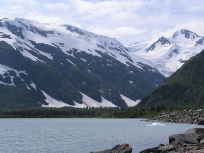
If you drive a little further there is a viewpoint where you can
actually see part of the glacier.
The Begich-Boggs Visitor Center, the glacier use to reach the visitor
center in 1911.
This either the Burns or Byron glacier.
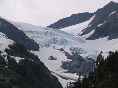
A hanging glacier in the distance.
Friday, July 11, 2008
Heading Home...
It was another full day of travel, I was flying from Anchorage to
Minneapolis and then to Toronto. My flight left at 9:30am Alaska time
and arrived at 10:08pm Toronto time.
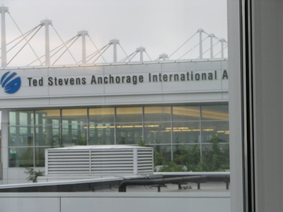
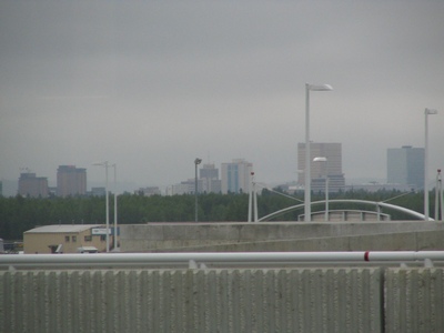
Anchorage off in the distance.
Inside the airport.
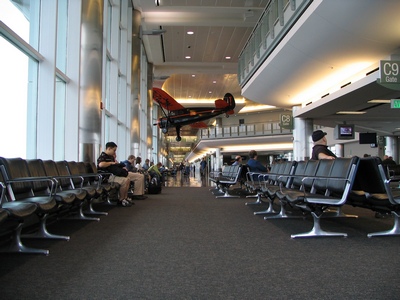
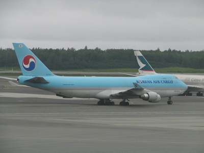
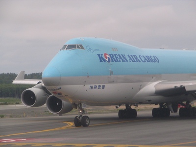
The airport is quite busy, there is alot of Cargo planes that are coming
from Asia and then heading south.
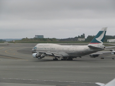
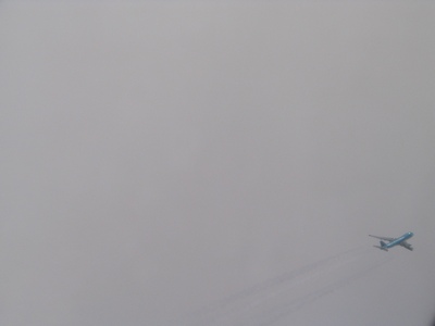
This cargo plane from Korean Air landed and took off shortly after we
did. It must have just been refueling.
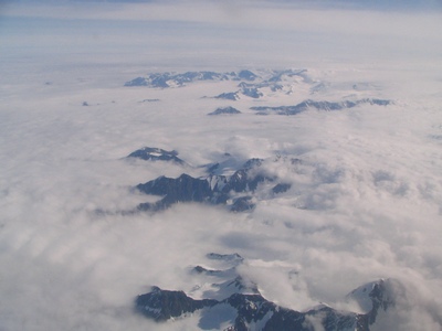
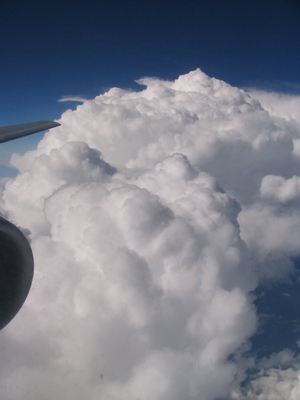
Flying over the mountains.
It was weird looking out the window and seeing another plane flying next
to us. It was the Korean Air cargo plane that was flying faster at a
lower altitude.
Closer to Minneapolis we went by a nice set of clouds.
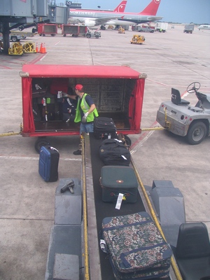
While we were waiting to take-off I watched as my luggage (the duffle
bag) was brought over from the other plane, it was nice to see it being
loaded. But a few minutes later I watched as they took it back off along
with other bags, I was thinking they may be redistributing the weight,
but it turned out there was a no show, so they had to remove the bags.
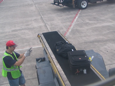
Here is my bag being loaded for a second time.
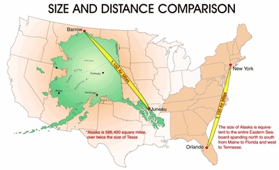
One last map to show how big Alaska is. If superimposed on a map of the
Lower 48, it would take up one-sixth the area, it is over twice the size
of Texas.
Thursday, July 24, 2008
Deep River Trip
I spent the week in the Deep River/Chalk River area. I was up at our
site located in the AECL facility at Chalk River. I stayed in Deep River
this time. It is a lot closer than Pembroke which was nicer. The
restaurant choices are limited, so we did end up down in Pembroke one
night. All the towns in that area are along the Ottawa River.
We had a good week of weather, unlike the Toronto area that had a lot of
rain and thunderstorms. Deep River is located across the river from the
Laurentians.
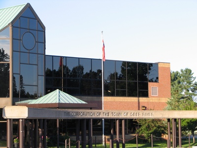
The town of Deep River was constructed in 1944 by the federal government
as part of the Manhatten Project for employees at the Chalk River
nuclear facility. The population is approximately 4300 and suprisingly
it has its own police force.
Tuesday, August 05, 2008
From One Coast to the Other
Within the span of a month I have traveled to both coasts. This week I
am in Newfoundland, in the Deer Lake/Corner Brook area. I am here to
re-start a sampling program that had been shut down last year due to
budget cuts. I am staying in Corner Brook during my short stay.
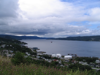
This is the Humber Arm which comes into Corner Brook.
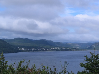
The Port of Corner Brook get both container and cruise ships coming into
port.
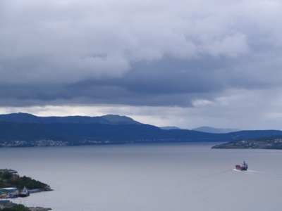
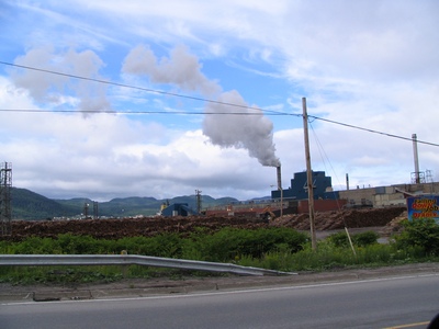
Corner Brook is a Pulp and Paper town.
Tuesday, October 07, 2008
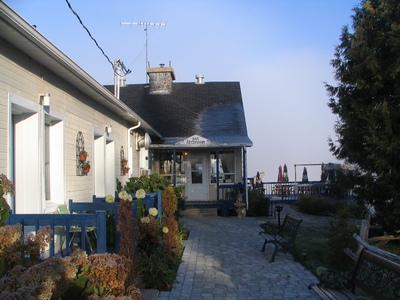
Domaine Lac Edouard
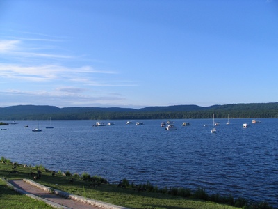
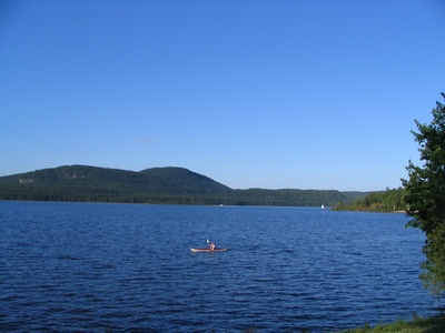
We were staying at Domaine
Lac Edouard, it is about 18km from where our site is located. The
lodge sits on the lake which is quite large. In the early morning it was
very peaceful, not such a bad thing after hitting a moose.
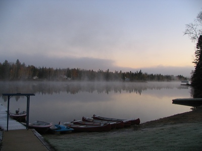
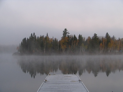
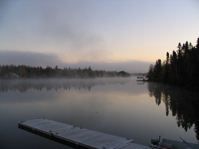
The lodge.
Monday, October 20, 2008
Third Time Zone...
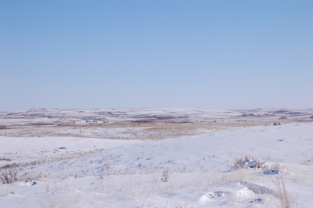
I'm in my third time zone in three weeks. This week I'm in Regina, will
be here all week. The weather should be good for most of the week.
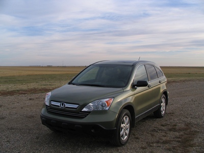
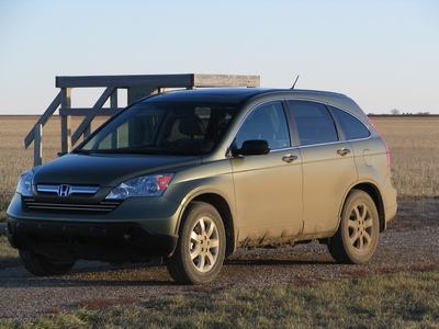
My ride for the week, a Honda CRV, notice how clean it is.
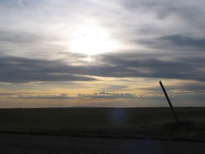
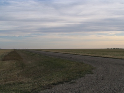
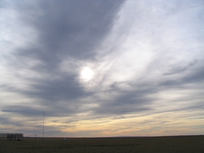
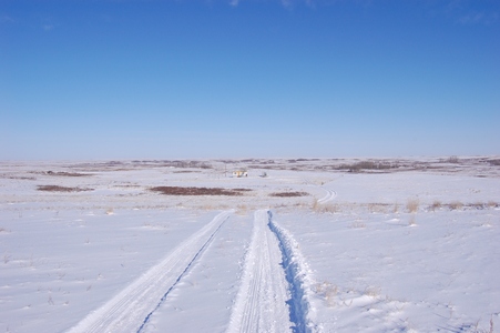
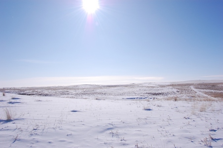
In case you forgot how flat the prairies really are.
Wednesday, October 22, 2008
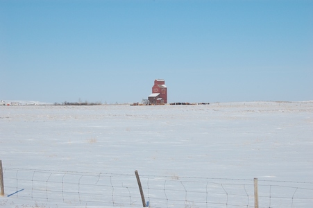
The Living Skies
It rained Tuesday morning, and when it rains out here it gets messy. The
soil sticks to your shoes and you grow a few inches. We went to Dog
River (Rouleau) and had lunch at the Dog River Hotel. Not sure what will
happen to Rouleau now that Corner Gas has wrapped up for good. The CRV
after traveling the Rouleau road.
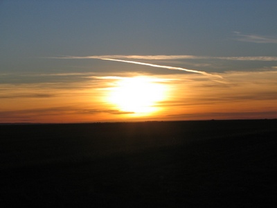
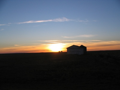
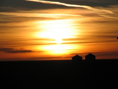
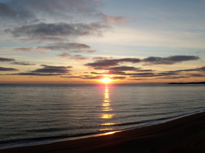
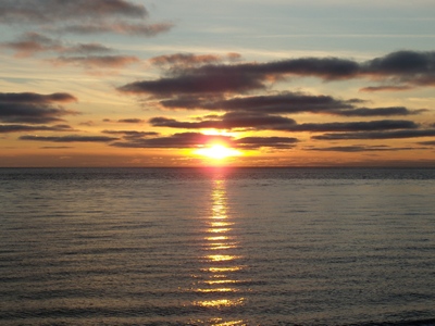
A few sunset photos from the site.
Along the RY Trail and Correction Rd.
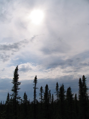
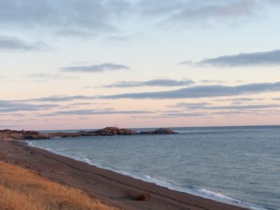
The land of the living skies.
Thursday, November 13, 2008
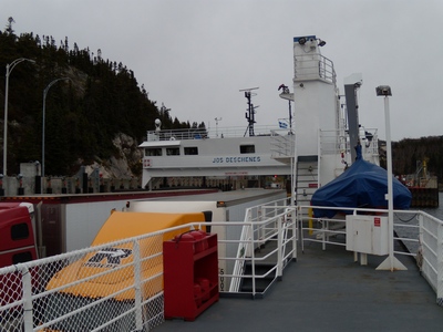
Ferry Ride
From Rivière-du-Loup, it was an early start to catch the ferry at
Matane.
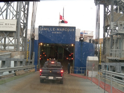
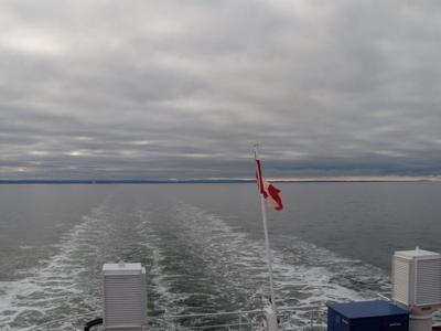
It is a 2 hour ferry trip across the St. Lawrence River to Godbout.

It was on to Sept-Îsles and then the site in Longue-Pointe-de-Mingan. It
was another long day, about 6 hours after we got off the ferry.
Sunday, November 16, 2008
Heading Back
Things went well with the installation and it was time for the long
drive back to Toronto. It was only back to Sept-Îles the first day.
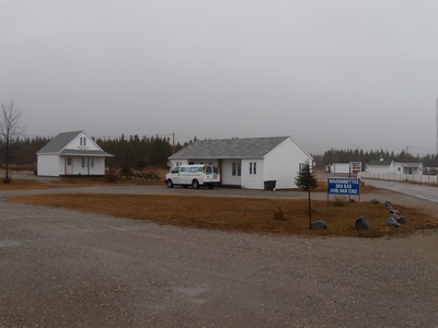
The accommodations for the week.
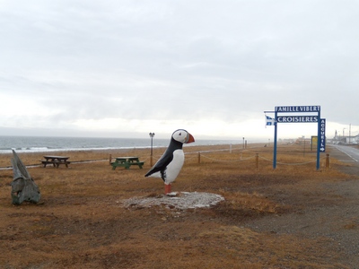
The big puffin.
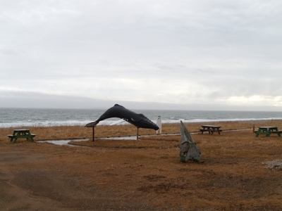
The big whale.
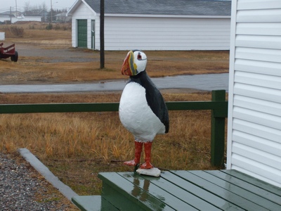
Another big puffin in front of the store.
Monday, November 17, 2008
Change of Plans
The weather wasn't co-operating forcing us to make a change in our
itinerary back to Toronto. We arrived at the ferry terminal, only to
find out that due to the weather the ferry had been cancelled. It meant
we had to drive back along the north shore along highway 138. The drive
along the north side is a little more hilly and the highway isn't as
nice. We did have to take another ferry at Tadoussac across the Saguenay
River.
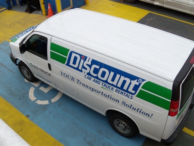
Our rental van.
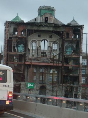
Our stop for the night was in Lévis, just outside of Quebec City. Not
sure what this building was, but it looked like it was cut in half.
Tuesday, February 03, 2009
Around The Camp
Temperatures for the week were hovering around -15°C during the daytime
and in the -20's overnight. We lucked out with the weather, usually it
is colder and overcast when I'm here at this time of the year.
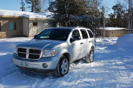
Our ride for the week was a 2009 Dodge Durango.
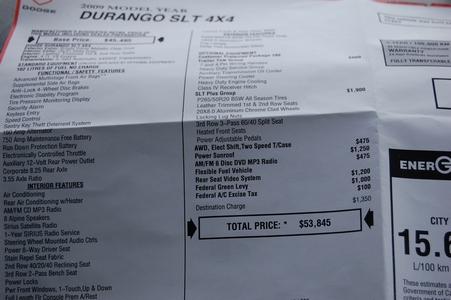
Here is the sticker price that I found in the glovebox.
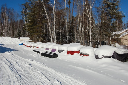
A row of buried ATV's that they use in the summer.
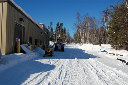
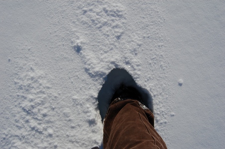
If you got off the main path the snow was deep.
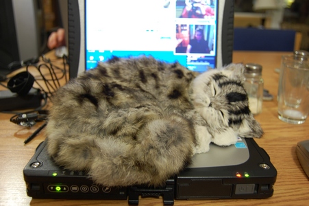
Found this fake cat in the residence. When it was sitting on the couch
it looked pretty real.
Wednesday, February 04, 2009
Following the Path
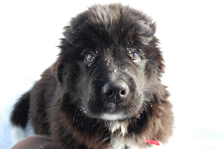
The camp manager has a new puppy, it is a 12 week old Newfoundland dog.
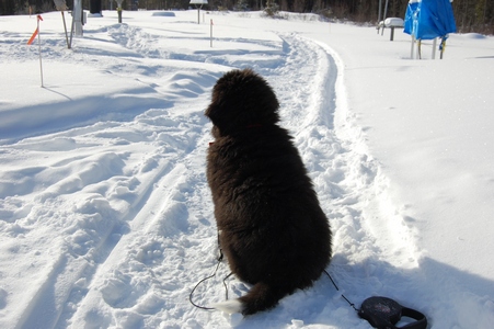
His name is Taiga.
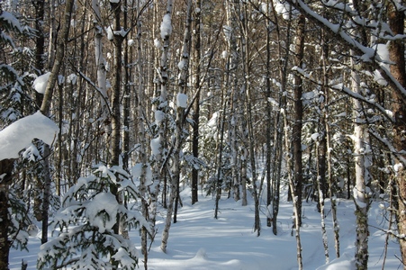
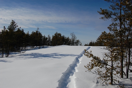
There was a path behind the building, so I followed it.
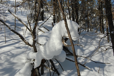
Some snow caught in the tree.
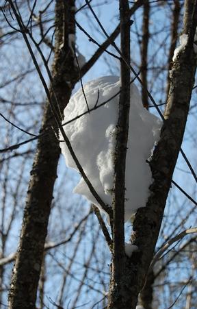
This one looked like a sea serpent.
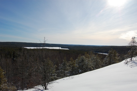
The path leads up to the top of a ridge behind the site. I found a cairn
at the top.
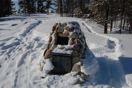
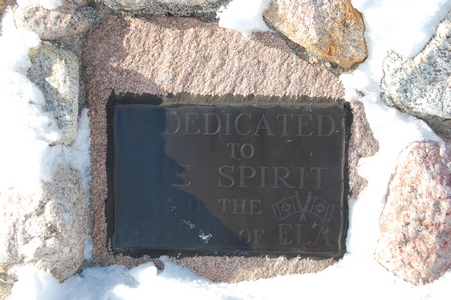
The cairn is dedicated to the spirit and people of ELA.
Looking towards the southeast.
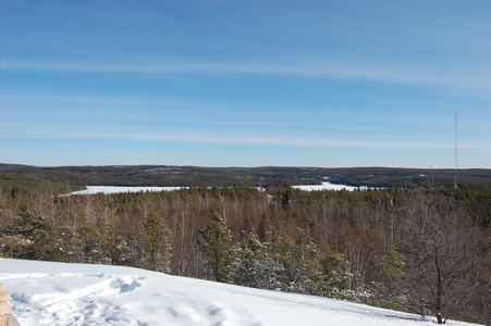
Looking southwest.
I didn't have time to explore the path any further.
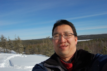
Trying to take my own picture with the new camera, not as easy as with
the point and shoot.
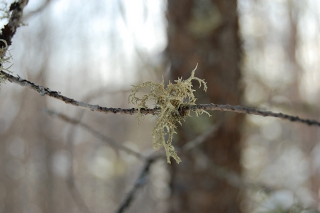
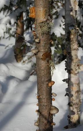
Some moss hanging from a branch.
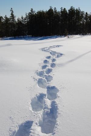
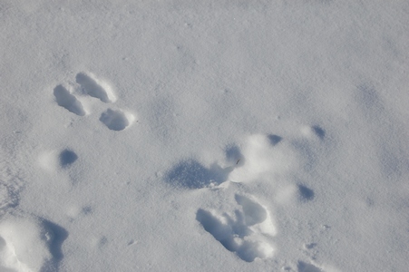
Lots of rabbit tracks, but didn't see any while I was there.
Tuesday, February 24, 2009
In the Middle of Nowhere
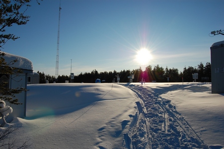
It was cloudy most of the day, but just before leaving the site the sun
came out.
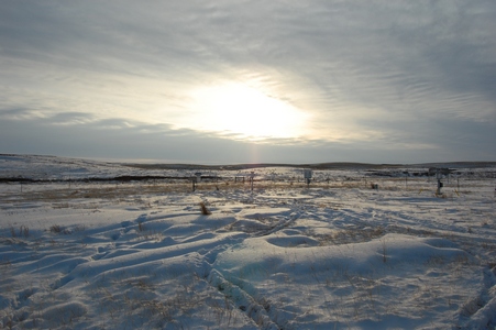
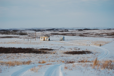
The site is in the middle of grazing land.
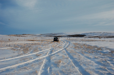
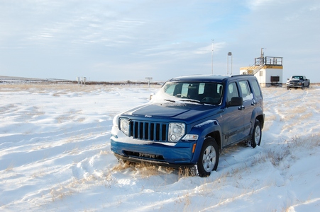
My ride for the week is another Jeep Liberty.
Looking towards the north.
Thursday, February 26, 2009
Where's Richard?
This was the first morning that the sun was out, but it also meant it
was going to be a cold one.
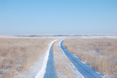
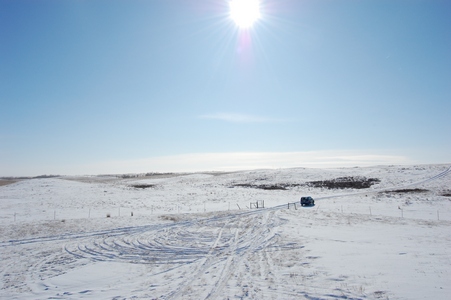
The road into the site, definitely one site where a 4x4 is required.
This is what some of our newer buildings look like, vandal and rodent
proof.
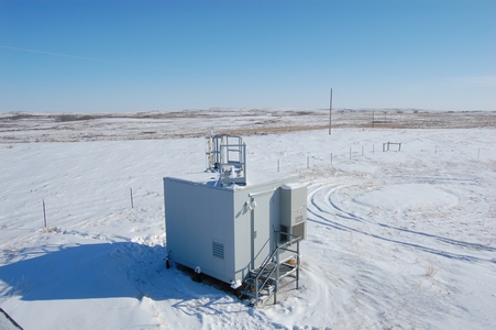
The temperature was -24°C and with the wind it was -34°C windchill.
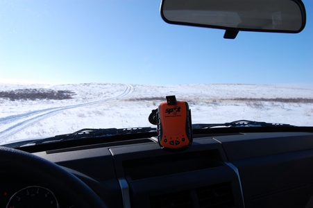
This is something new that we have started using, it is a Satellite
Personal Tracker, also known as SPOT. It allows us to check-in with the
office while we are in the field to let them know we are okay and have
made it to where we are suppose to be. It has four functions, it can
send an e-mail for help, an e-mail to say OK, a 911 emergency request or
it can track your movement. A lot of times we are in areas where there
is no cell coverage, this allows us to still check in with the office.
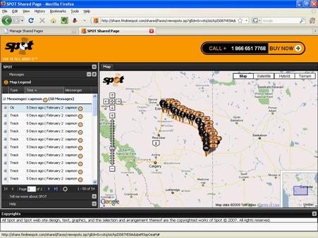
It uses the GPS satellites to pin point your location and then it uses
the communication satellites to send out an e-mail to people on your
list. Each e-mail has a Google maps link that shows where you are. It
also allows you to have shared
web pages that show your movements. They say that if that couple
from Montreal who got lost near Golden, BC had a SPOT they would have
been found within hours and not 10 days later.
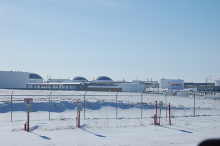
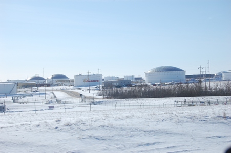
A few more photos as I was leaving the site to drive back to Edmonton.
The huge holding tanks near Hardisty, AB.
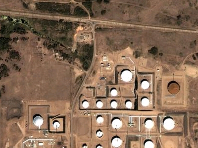
A Google maps satellite view.
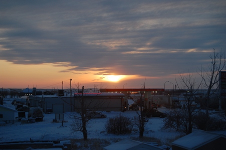
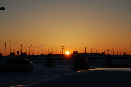
The setting sun in Leduc, AB. Staying out near the airport before flying
back to Toronto friday morning.
Tuesday, March 10, 2009
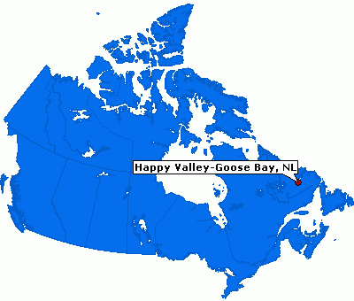
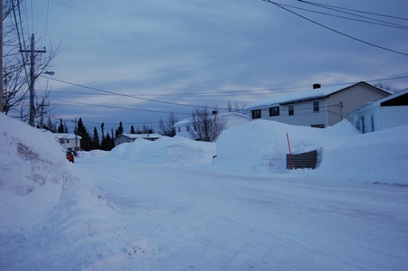
Goose Bay, Labrador
I'm in Labrador this week for a few days. I lucked out with the weather,
it was sunny today and a some of the same for tomorrow. This is my first
visit to Goose Bay and Labrador. Here is a map showing Goose Bay.
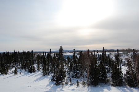
There is about 150 cm of snow on the ground.
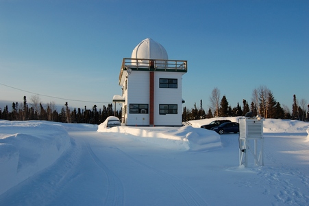
The site is located at an Environment Canada Upper Air site located in
town.
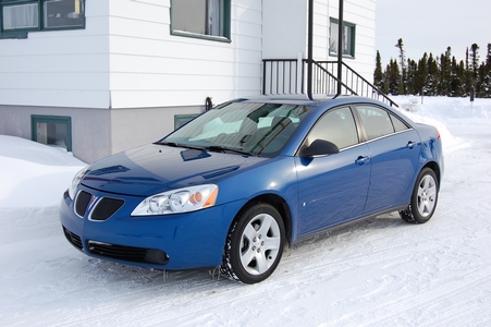
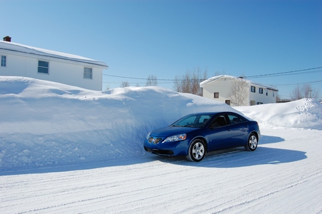
My car rental is a Pontiac G6.
There is a lot of snow here.
Wednesday, March 11, 2009
Now This Is Snow
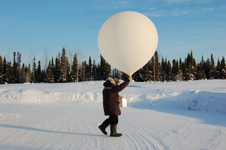
This site also does upper atmosphere measurements for Environment Canada
as well as tropospheric ozonesondes. On this morning the operator was
doind an ozonesonde.
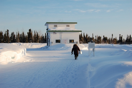
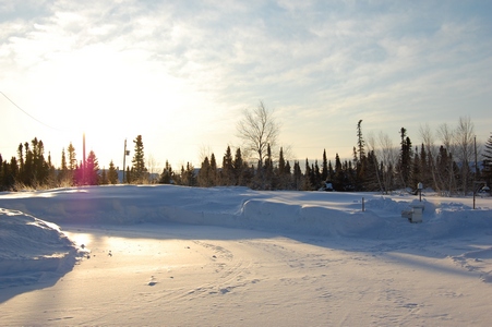
It was a bright sunny day, but not too cold, only around -5°C.
Preparing the weather balloon.
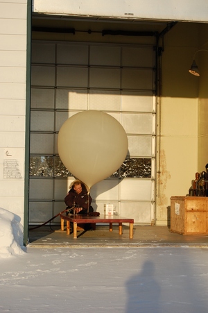
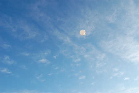
Ready to launch, prior to launch they have to get permission from the
local airport.
Up, up and away
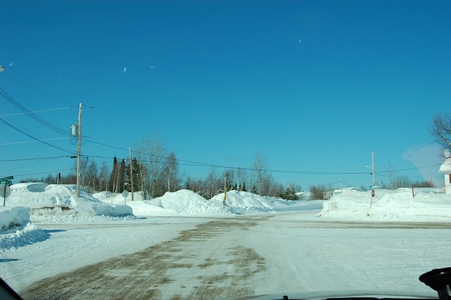
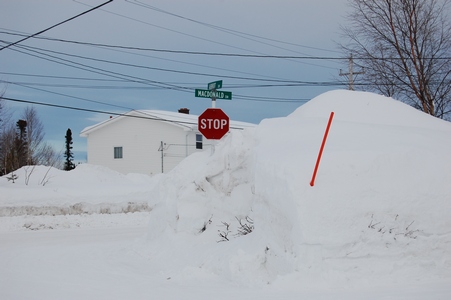
This intersection had five stop signs. You can count four of them, plus
the one I was stopped at.
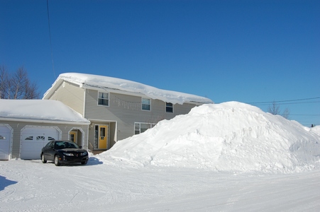
Some of the snow is up to the second floor. This is all snow that has
fallen, no drifting here.
The snowbanks are almost twice as high as my car.
The snow is higher than the stop signs.
Main page